WCS continues to collect data on the presence of marine mammals and the noise levels they are exposed to in the Northern Bering and Eastern Beaufort seas. As part of this project I went back to Nome, Alaska during the spring of 2017 to work with boat captain Adem Boeckman and his crew on board the F.V. Anchor Point. Our efforts started with a trip to the Bering Strait that took us along King Island’s west coast. Passing the island, we got a good view of Ukivok, a stilted village once the winter home of 200 Iñupiat Alaska Natives, but that now lays abandoned.
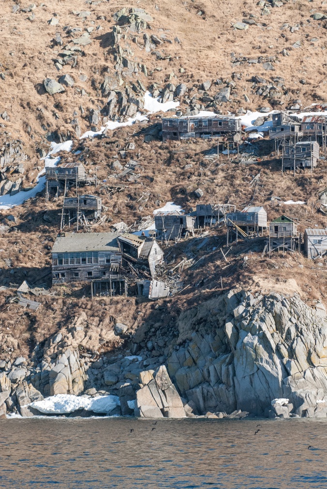
The abandoned village of Ukivok, located on King Island’s west coast.
Leaving King island behind, Adem steered the Anchor Point northwards toward the Bering Strait. This course took us right along the commercial shipping lane proposed by the U.S. Coast Guard as part of the Bering Sea Port Access Route Study. Creation of this shipping lane seeks to minimize environmental and safety risks in this area that is rich in wildlife and of profound importance for indigenous subsistence communities, but lacking in salvage and rescue capabilities. Shipping traffic is predicted to increase in this area, but navigating northwards along the shipping lane we encountered no other vessels (although vessel traffic is generally higher later in the summer). The clear weather provided us with wide views stretching from the Alaskan coast to the East, all the way to the Russian coast to the West.
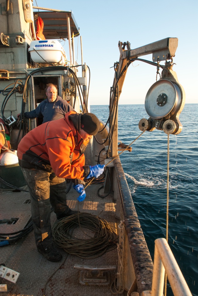
Adem Boeckman and James Longley retrieve a sound recorder from the Bering Sea. Photo Ricardo Antunes.
After several unsuccessful attempts to recover one recorder in Bering Strait, we headed southeast and closer to shore. Everyone on board couldn’t avoid feeling disappointed at the loss of a recorder. There is always a risk of losing equipment that we deploy on the bottom of the sea for months on end, subject to the energetic conditions and shifting substrates of the Bering Sea, and particularly through the notorious storms. More than the equipment itself, it’s the data it contains that is invaluable. These data are essential as we try to better understand the patterns of marine mammal presence, and how levels of underwater noise are changing in this part of world.
Further along our return trip to Nome our mood recovered when we successfully retrieved the first recorder of the trip. Once again the F.V. Anchor Point’s gear hauling equipment, usually used for crab pots, was invaluable in retrieving the heavy moorings that secure our equipment to the substrate. The size of Adem’s boat allows us to work in ways that wouldn’t be possible using a smaller vessel. Navigating closer to shore, Adem had to slalom the Anchor Point through a field of drift ice while we kept ourselves entertained spotting walruses swimming around the boat and hauled out on the ice. As someone who spends hours and days watching spectrograms and listening carefully to recorded underwater noises, it was gratifying to make closer acquaintance with the originators of some of the sounds!
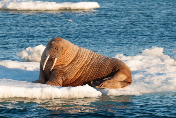
A walrus hauled out on an ice floe in the Bering Sea. Photo: Ricardo Antunes.
With continuing good weather on the horizon we soon followed with another trip to St. Lawrence Island to attempt to recover more recorders. We first approached the island at the northeast cape and then moved along towards the hallowed Punuk Islands. At this point, we were visited by a group of Alaska Natives from Savoonga. They had been hunting off Punuk for several days and were trying to return back to their home village on the north coast. Persistent winds had made the return trip impossible for days and and they were running low on water and other essential goods. This late in the spring hunting season, floes of sea ice are smaller and thinner, and become brackish, not allowing the hunters to extract fresh drinking water from the ice.
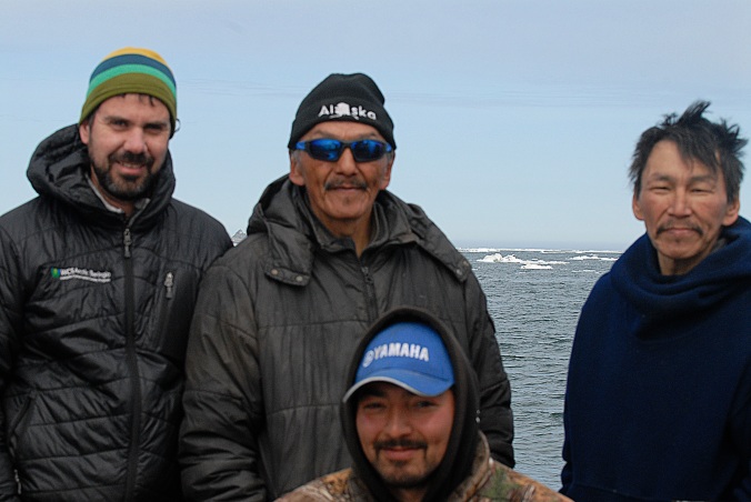
WCS researcher Ricardo Antunes and Savoonga hunters off Punuk Island.
Our encounter with local hunters was a fresh reminder of the dependence that Alaska Natives have on natural resources for their subsistence and cultural identity – a key reason they are also looking to expand their role in the stewardship of their environment. The ongoing changes in this part of the world, caused by climate change and increased shipping, will undoubtedly impact their livelihoods.
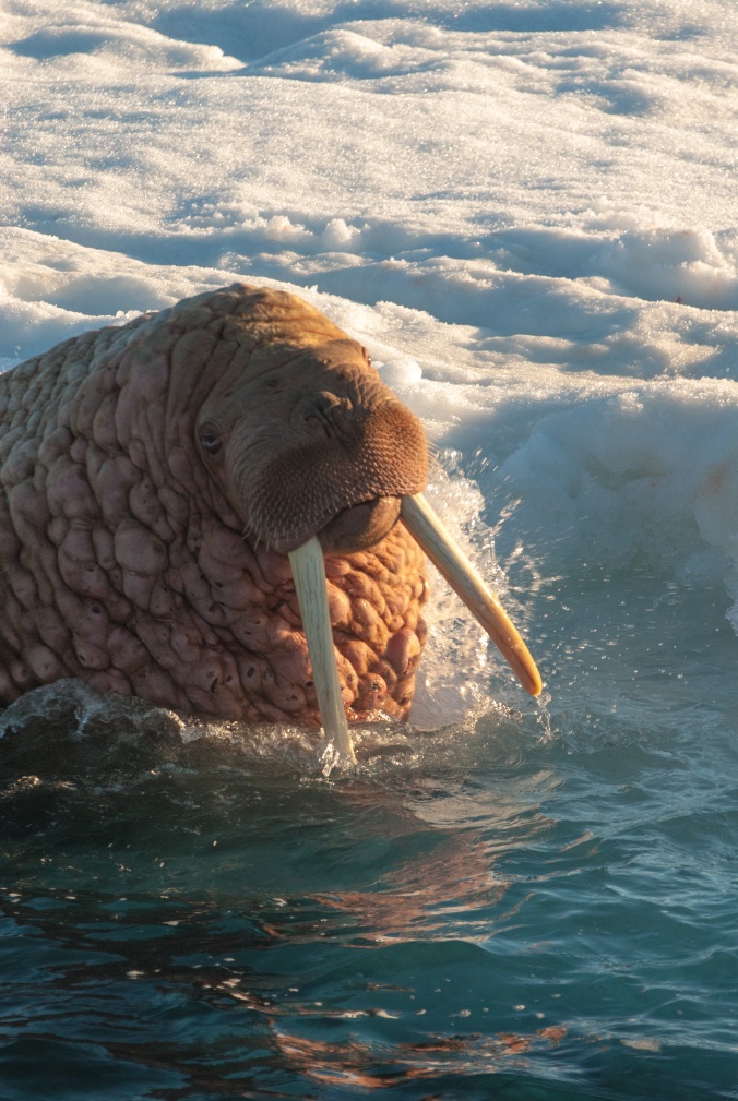
A large male walrus swims among ice floes in the Bering Strait. Photo: Ricardo Antunes.
After sharing water and other goods with our visitors, we proceeded by rounding the island’s Southeast Cape and steamed along the south shores across Powooiliak Bay. At Southwest Cape we recovered two more instruments, one of which had been deployed for two years. Together these two deployments extended over a period of 18 months. We were thrilled to discover that the instruments had worked flawlessly and were loaded with data from this important location that hosts most whaling operations for the Savoonga hunters each spring. Powooiliak Bay is where the St. Lawrence polynya (an area of open water amidst the extensive sea ice cover) develops every year, and where bowhead whales congregate during the winter months. Data from these instruments will help us get a better understanding of when these critically important whales occur in this area.
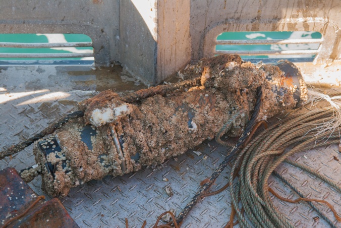
After two years at the bottom of the Bering Sea, a sound recorder lies on deck after recovery. Photo: Ricardo Antunes.
The next stop of the trip was off Gambell, the Alaska Native village at the Northwest Cape of St. Lawrence island – a mere 40 miles from the clearly visible Russian coast! We have been deploying here longer than any of other locations, starting in the summer of 2013 when we deployed our first recorder from a local hunter’s skiff. We hope to build a long-term dataset to better assess any changes caused by climate change.
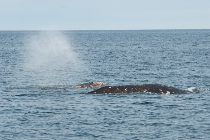
A pair of gray whales swims in Bering Sea waters of Gambell. Photo: Ricardo Antunes.
Gray whales have been a constant presence at Gambell every time that we have been here, both in the fall and the spring trips. The team has become used to seeing individuals and groups of two and three whales foraging around the ship while recovering and deploying our sound recorders. This trip was no exception.
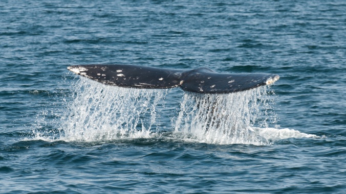
A gray whale dives to feed off of Saint Lawrence Island. Photo: Ricardo Antunes.
We returned to Nome filled with excitement about the new data on board and the revelation that would result from its analysis.
For additional updates about the results, the team, and to hear some of the amazing marine mammal vocalizations, please see summary.wcs.org. Blog written by Ricardo Antunes, WCS, July 2017.