Winter Lagoon Explorations

This April we had the chance to travel back to our summer stomping grounds in Cape Krusenstern National Monument. We arrived in Kotzebue to a wash of white; what was previously a sea of rolling swells and breaking waves was now a sheet of ice as far as the eye could see. Despite the early spring conditions, a brisk breeze continued to blow through town, sending chills down limbs.

IMG_1272

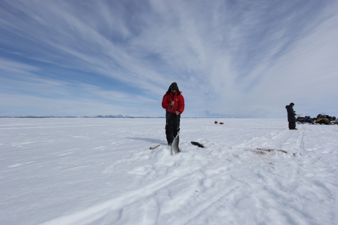
Trevor Haynes pulling a sheefish through the ice. Photo M. Tibbles.

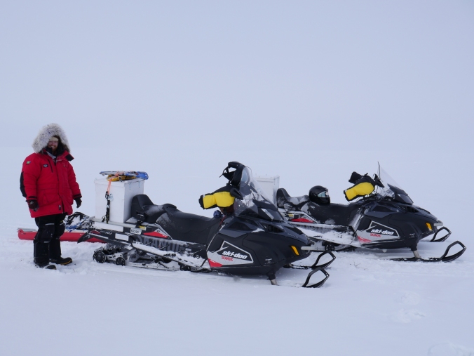
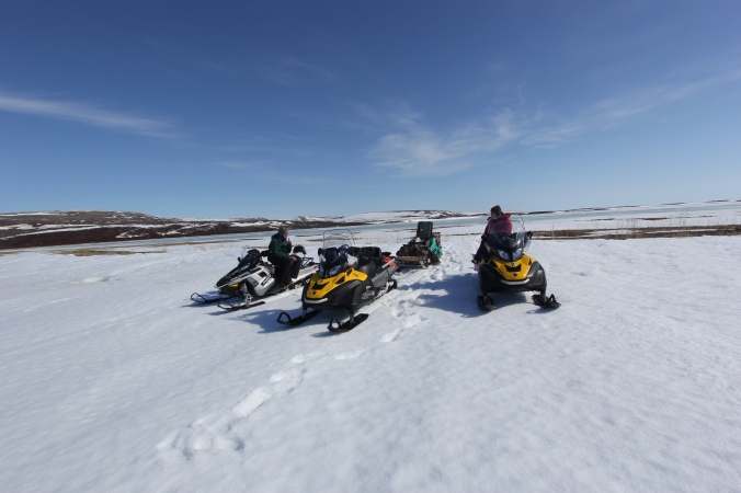
Our first day in town, we had the opportunity to travel to Kobuk Lake by snow machine to go ice fishing, accompanied by old and new friends including Bill Carter and the Selawik National Wildlife Refuge office, Alex Whiting (Native Village of Kotzebue), Todd O’Hara (UAF), and several subsistence fishermen. We drilled holes through the 5 feet of ice with a gas-powered auger, hoping to catch some sheefish. Beneath the ice, schools of sheefish swam by our holes in waves. It would be quiet, heads down, hands jigging. Suddenly, exclamations would come from all around the group as giant silver sheefish were dragged onto the surface of the ice. We caught over 50 fish as a group in the span of a few hours, and everyone went home thrilled after having such a fantastic day of fishing. These fish are essential to the food security of this and many other villages in the region.

IMG_1798

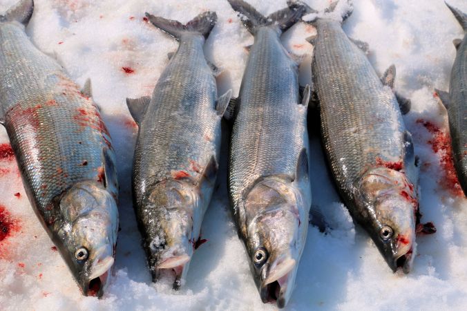
Sheefish. Photo A. Whiting.

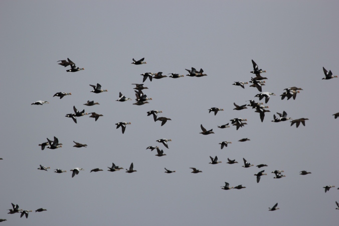
Not only were the fish plentiful that day, so were the caribou. We had the luck to watch a herd of caribou stream down onto the ice, briefly unaware of our existence. The sounds of snow machines alerted the herd to our presence shortly after their appearance and they headed back up off the ice.

IMG_1284

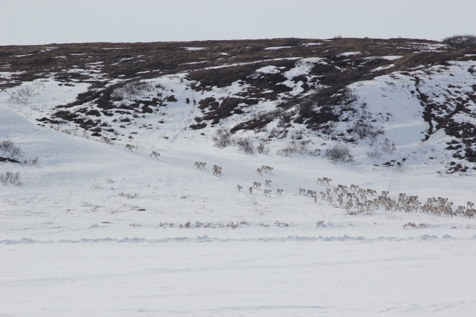
Caribou streaming down from the hills onto Kobuk Lake. Photo T. Haynes.

The real work for us began two days later with a snow machine trip across Kotzebue Sound and into the frozen maze of wetlands surrounding two of the lagoons we monitor during the summer months –Krusenstern and Aukulak lagoons. We drilled several holes in creeks and sloughs to observe the ice thickness and the presence and conditions of any water below the ice. We were looking for oxygenated water, which indicates areas where fish could survive the long winter under the ice. This is part of our effort to work with local experts towards understanding where fish overwinter and find the critical habitats that are often ignored by researchers due to the difficulty of sampling during the cold harsh winters.

IMG_1304

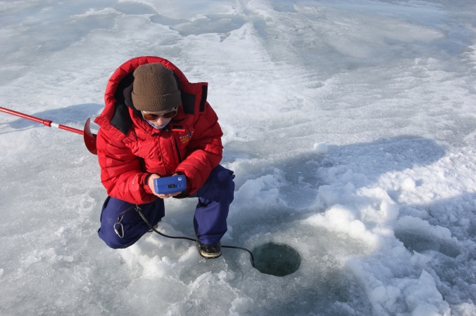
Marguerite Tibbles measuring water quality parameters beneath the ice. Photo T. Haynes.

When we finally reached Krusenstern Lagoon, we watched a red fox scamper off into the distance. We took an ice core from the lagoon to determine the salt balance in the winter. Measuring the salinity of the ice core as well as the water beneath the ice and comparing these measurements with the salinity of the water before freeze-up will allow us to determine if Krusenstern Lagoon has a connection to the marine environment during the winter. Understanding the physical properties of the lagoons is another important step in revealing the mysteries of the coastal lagoons of the Arctic.

All of these preliminary measurements will guide future efforts to find overwintering habitat of fish and monitor ice conditions in partnership with the National Park Service. This exploratory trip was a huge success thanks to the help of so many people, and will hopefully become a yearly excursion.

IMG_1322

The crew eating lunch at Cape Krusenstern Lagoon. Photo T. Haynes.

Written by Marguerite Tibbles, WCS Research Technician. May 2016.

River of Birds

During the second field season for the king and common eider population estimate at Point Barrow, Alaska (Niksiuraq), strong, persistent winds from the East prevented birds from migrating until much later than the previous year. But once the wind shifted, it was as if the floodgate had been lifted, and the birds poured past in a great river of wings. One day in early May, an estimated 18,000 birds passed in two hours.

IMG_1437

King and common eiders migrating past Point Barrow, Alaska. Photo T. Haynes

The field season is ongoing. Birds are still migrating to their summer breeding grounds, but the wind has shifted again, the lead between the pack ice and the shore-fast ice has closed, and the majority of the population seems to have passed. The memory of the sight and the sound of so many thousands of birds in the sky remains.

Written by Sally Andersen, WCS Arctic Beringia Program Conservation Coordinator, April 2016.

First Attempts: Tracking Wolverines on Alaska’s North Slope

On April 29th, Ross Dorendorf and I swung our legs over our snow machines and gave each other a thumbs up; it was time to head home. We had just completed the initial season of the first ground-based collaring effort for wolverines on Alaska’s North Slope in 35 years – the second ever – and were pleased to call it a success. For fifty days we ran four traps, complemented by ten bait stations, covering approximately 500 square miles of tundra near the oil camp of Umiat. It was the first effort to shed light on how wolverines use deep snow as a structural feature of their habitat, and it was very much a pilot season, one of several to come. In a landscape where woody plants are scarce, we had no way to know what the wolverines would think of our wooden traps constructed of commercial 4x4s, but we hoped that the animal’s characteristic curiosity and namesake gluttony would overcome any reservations it had about jumping in.

P1030195

Tom Glass prepares the snow machines for daily checks of the wolverine traps. Photo R. Dorendorf

Though slow to start, we ultimately captured four different wolverines (possibly five – one got away before we reached the trap), and collared three. With the generous aid of the Alaska Department of Fish & Game, we were able to deploy two more collars, for a total of five wolverines now out on the tundra, transmitting data. Two are lactating females.

P1030585

Tom Glass holds an adult male wolverine after removal from the box trap (in background). Photo R. Dorendorf

But this figure is only a part of what allows us to claim success. In our seven weeks there, we also collected 88 scats for diet analysis and genetic information, followed over 40 miles of wolverine tracks to understand where the animals traveled, remotely observed what may be the first GPS documentation of a wolverine traveling on sea ice, and deployed 13 motion activated cameras on snow-holes created by wolverines.

P1030426

Following the wolverine on Alaska’s North Slope. Photo R. Dorendorf.

This last number is worth expounding. With the aid of aerial observers Tina Laird, Mark Keech, Pat Valkenburg, and Audrey Magoun, we located and investigated around twenty holes dug by wolverines in the snow. On the surface, these holes are unassuming. Some are accompanied by scat or food remains (often caribou or moose bones), while others are meticulously clean. Some have dozens of tracks coming and going, while others appear to have only been used once. At some, the opening is small – often a mere 7-8”—while at others a wide entrance leads into a large (~2′ diameter) cavern. Some are created in relatively shallow snow, while others are dug into meters-deep drifts, often on the lee of cut banks or lake shores.

IMG_0049

Photo of a female wolverine captured by remote camera near a den site on Alaska’s North Slope.

We are intensely curious about these holes. Around the world, wolverine distribution is strongly correlated with snow that persists late into spring, but no one fully understands why. In the Lower 48, where increasingly warm winters mean less late-season snow, this relationship may put the species in peril. On the tundra, wolverines seeking some sort of structure (for protection from predators, to raise their kits, to store food, or for any number of other reasons) have little choice but to dig holes in the snow. Unlike wolverines in most other places, these animals live above treeline, and cannot hide under boulders (for the most part – there are few here), root wads, or downed timber. They must entirely create their own structure.

We think that snow on the North Slope may play a crucial role in the life of a wolverine, and that coming to understand this role may unlock if and how the changing climate will impact wolverines in the Lower 48, and around the world. In three weeks, I will return to the study area to collect our thirteen cameras, which we hope hold a first glimpse into this mystery.

In the meantime, our aerial observers are back at it, investigating whether GPS-clusters transmitted by our collared animals might be dens or other snow structures. Very little is known about how wolverines use snow for structure, and we hope to change that.


Written by Tom Glass, WCS Wolverine Research Technician. April 2016.